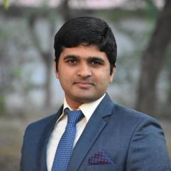
Prakash Pilinja Subrahmanya
Dr. Prakash is a postdoctoral fellow at ICHEC working on geo-spatial technologies . In November 2021, he joined ICHEC in Galway, Ireland. Prakash has substantial experience with earth observation datasets, including remote sensing, drone-based imagery, spatial libraries, machine learning, and artificial intelligence technologies.
In the year 2021, he received his doctorate from the Indian Institute of Technology, Kharagpur. His doctoral thesis is on applying deep learning and geoinformatics to extract urban features. Open-source technology, geospatial data, machine learning, renewable energy, urban infrastructure, and other topics are among his interests. He has worked in geospatial technology and the renewable energy industry for over four years.
His qualifications include a Master of Technology in Geoinformatics from Bangalore's Karnataka State Remote Sensing Application Center and a Bachelor of Civil Engineering from Bangalore's Rastreeya College of Engineering.
Interests
Prakash loves to play tennis and listening to soft music. His favourite hobbies are mountain hiking and cycling. Additional Prakash is a yoga enthusiast who is interested in cultivating a sense of inner peace.
Journal publications
- Prakash, P.S., Bharath, H.A., (2021) Digital building height preparation from satellite stereo images, PE&RS. Accepted –in print (Journal ranking in the field: 2/30)
- Prakash, P.S., Bharath, H.A., Satarupa, M., 2020. Automatic Extraction of Buildings from UAV- based Imagery Using Artificial Neural Networks, Journal of the Indian Society of Remote Sensing. Published online
- Bharath, H.A., Soumya, K.D., Prakash, P.S. 2020. Urban 3D structure reconstruction through a generative adversarial network model. Arabian Journal of Science and Engineering, Published online
- Prakash, P.S., Bharath, H.A. 2020. Retrieval of Building Roofs using High-Resolution Satellite Imagery through Machine Learning Approach, Malaysian Journal of Remote Sensing & GIS, 9(1), pp. 1-15
- Sowmya, K.D., Prakash, P.S., Bharath, H.A. 2018. Automated Building Extraction using High-Resolution Satellite Imagery through Ensemble Modelling and Machine Learning, Remote Sensing of Land, 1(1) Pp. 1122-1136
Chapter in a book
- Prakash, P.S., Nimish, G., Chandan, M.C., Bharath, H.A. 2021. Urbanization: pattern, effects and modelling. In: Machine Learning for Urban Computing, Springer. Published online
Conferences publications
- Prakash, P.S., Mansi, U., Bharath, H.A. 2021. Deep Learning based architectures for semantic segmentation of aerial imagery. In proceedings of 2nd International Conference on Unmanned Aerial System in Geomatics - 2021, April 2021, IIT Roorkee Delhi, India.
- Vishal, S., Prakash, P.S., Bharath, H.A. 2021. Evaluation of rooftop solar photovoltaic potential using Machine learning and Geoinformatics, In Computational Urban Planning and Urban Management at HEL 2021 (CUPUM), Finland.
- Prakash, P.S., Bharath, H.A. 2020. Assessment of urban built-up volume using geospatial methods: a case study of Bangalore. In Proceeding of IGARSS 2020, USA. July 2020. Published online
- Das, S. K., Prakash, P. S., Pandey, A. C., & Bharath, H. A. (2020). Urban Surface Simulation Through Image-to-Image Translation Deep Learning Algorithm using Optical Aerial Imagery. In Proceeding of IGARSS 2020. Published online
- Prakash, P.S., Bharath, H.A., 2020. Rooftop solar potential estimation using UAV through deep learning for efficient infrastructure development. In Proceedings of ASCE 2020, Kolkata, India. March 2020
- Prakash, P.S., Vishal, S., Bharath, H.A. 2020. UAV Based Sensor Data for Efficient 3D Building Extraction Using Machine Learning. In Proceeding of ISRSNS 2020, Gujarat, India. December 2020.
- Chandan, M.C., Aadithyaa, J.S., Prakash, P.S., Bharath., H.A., 2019. Integration of Particle swarm optimization with SLEUTH for Urban growth pattern visualisation. In proceedings of 55th International Society of City and Regional Planners congress (55th ISOCARP-2019), Indonesia. Published online
- Prakash, P.S., Satarupa, M., Bharath., H.A., 2019. Automatic extraction of building features from UAV using artificial neural networks. In proceedings of 1st International Conference on Unmanned Aerial System in Geomatics, IIT Roorkee Delhi, India.
- Nimish, G., Chandan, M.C., Prakash, P.S., Bharath., H.A., 2019. Characterizing the relationship between land use pattern and land surface temperature with automated built up extraction: Process, pattern and modelling. In proceedings of EGU General Assembly, Vienna, Austria.
- Bharath., H.A., Chandan, M.C., Nimish, G., Prakash, P.S., 2018. Modelling and characterizing the urban growth pattern in Silicon Valley by establishing a relationship with LST and Building footprint. In proceedings of AGU fall meeting, USA. Published online
- Prakash, P.S., Soumya, K.D., Bharath., H.A., 2018. Urban building extraction using satellite imagery through Machine learning. In proceedings of IEEE SSCI, November 2018, Bangalore, India. Published online
- Prakash, P.S., Bharath., H.A., 2018. Building rooftop extraction and estimation of solar energy capabilities using machine learning. In proceedings of National Symposium is Advancements in Geospatial Technology for Societal Benefits, December 2018, Ahmedabad, India.


